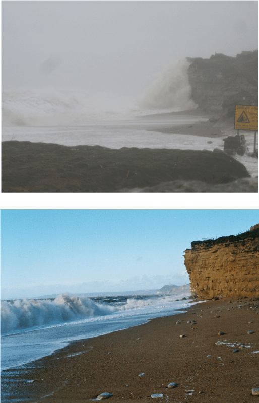
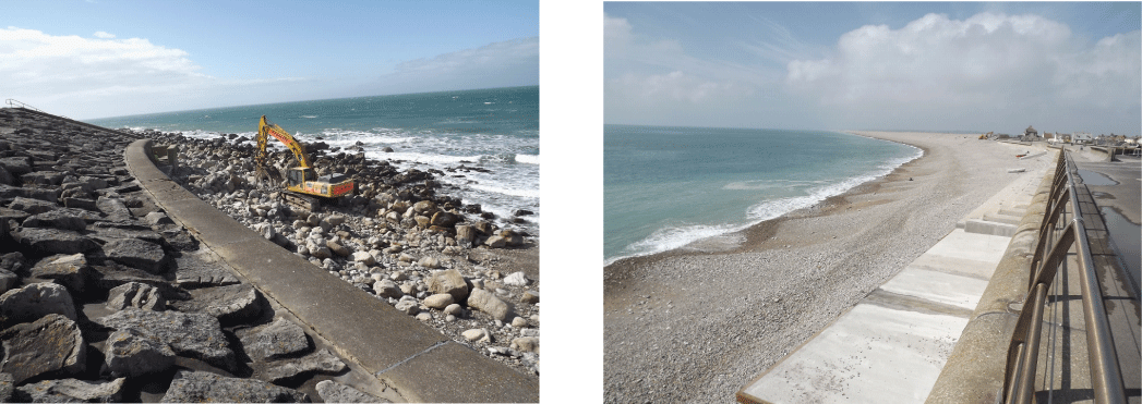
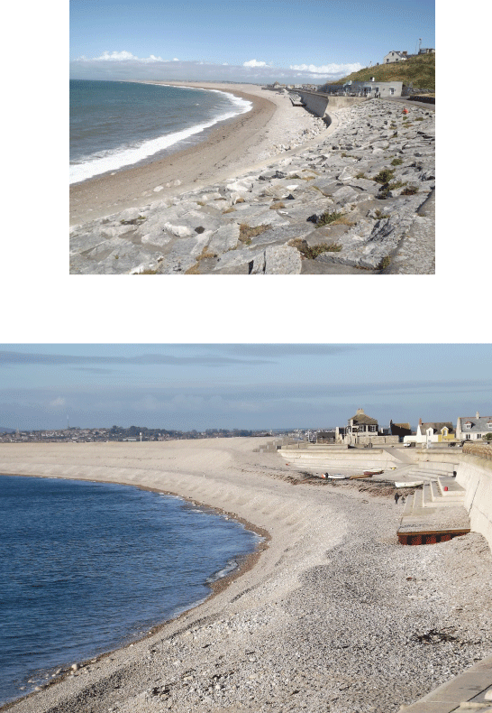
Freshwater between West Bay
and Burton Bradstock
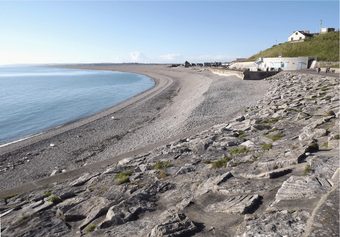
The beach in Chesil Cove
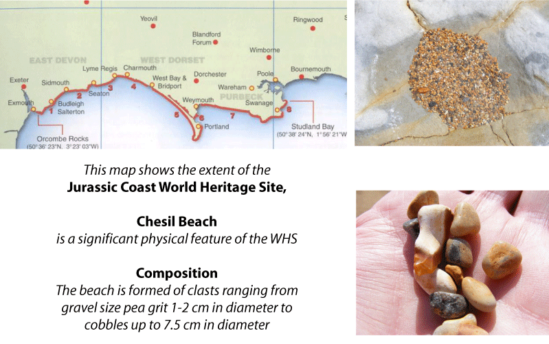
The pebbles are smallest at the north-west end. The larger pebbles occur at the south-east end
Lyme Bay
ridges formed by wave action at various states of the tide
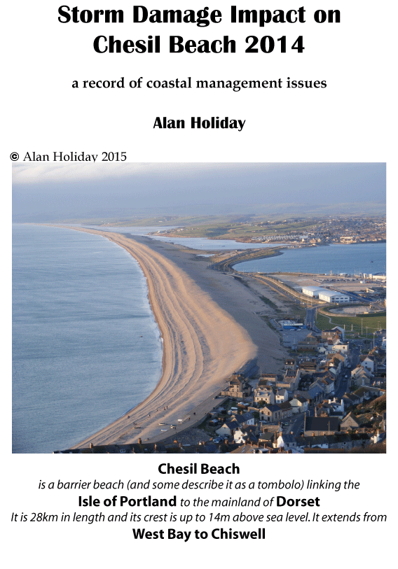
crest height up to 14 metres above sea level
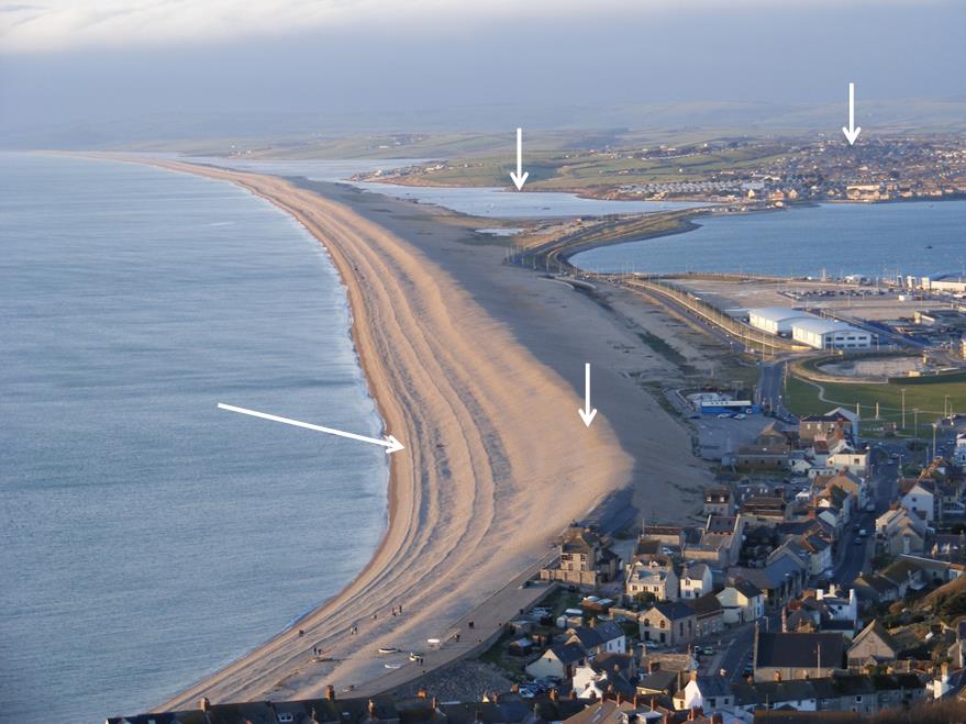
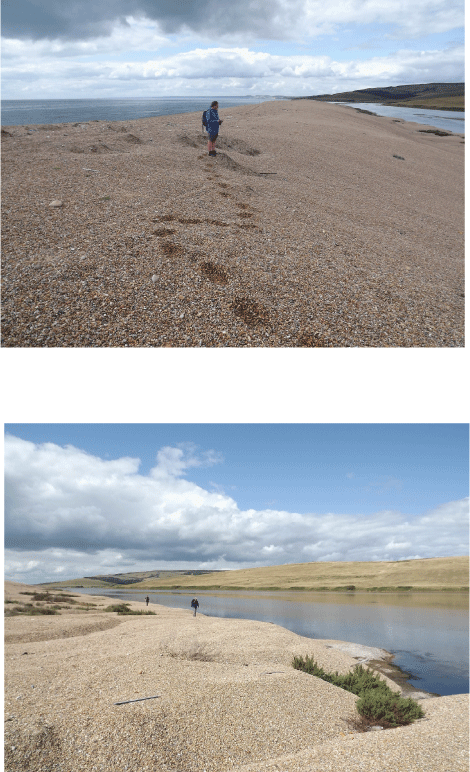
The Fleet, a lagoon which
opens out into Portland Harbour
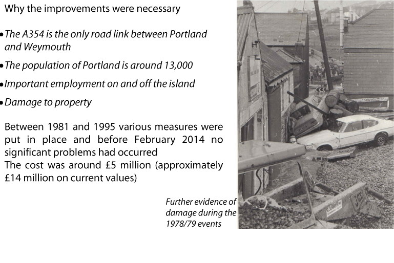
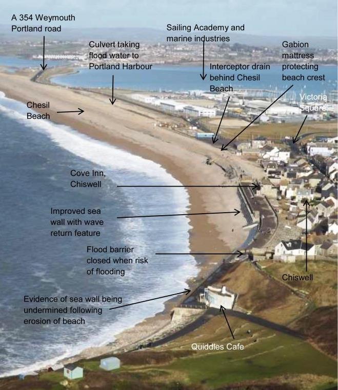
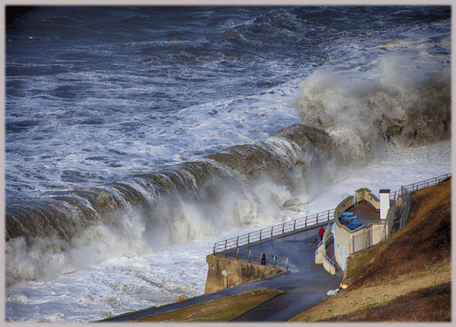
Weymouth
Victoria
Square
Portland Harbour
Coastal defence improvements in Chiswell following flooding in 1978-79. Off-shore wave buoys and alarm systems for residents were also put in place
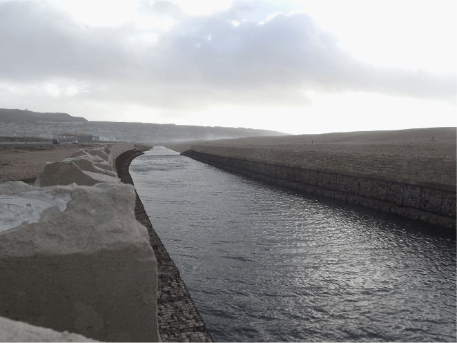
January 6th 2014: storm drain filled with water on during a storm event
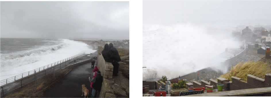
Note spray from storm waves coming in over the beach
16th May 2013 Chesil Cove: showing the state of the beach built well up on sea wall before any storm damage. Note arrowed height of the shingle
v
v
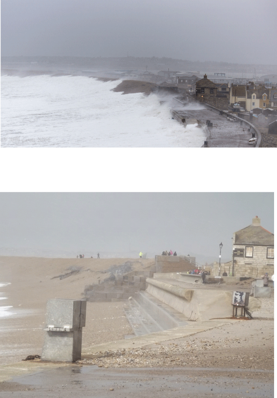
3rd February 2014: beach view
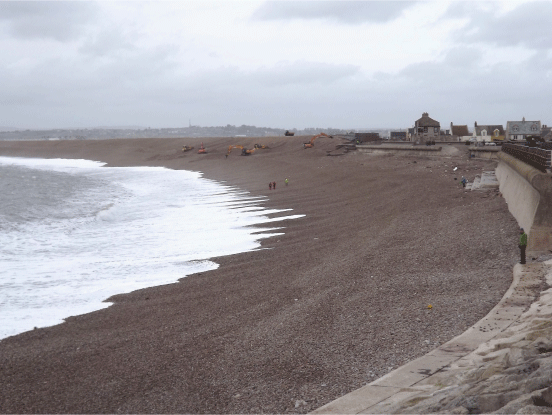
2nd February: Waiting for the storm, Environment Agency on site. Flood gates closed, note the beach level
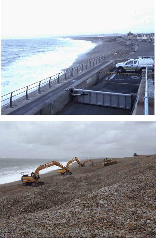
3rd February: Environment Agency at work building up the beach
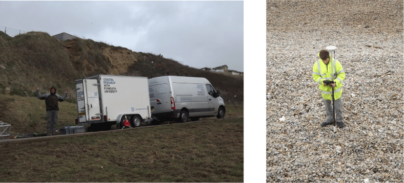
3rd February: Plymouth University monitering the beach
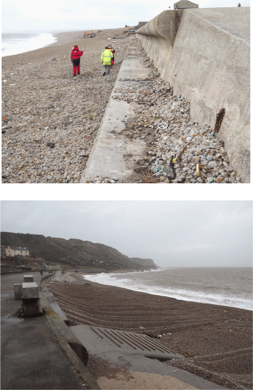
3rd February: shingle level
4th February: beach level following work by the Environment Agency
5th February: storm waves at Burton Bradstock
Sam Scriven
6th February: View of the storm at Quiddles Cafe, Portland
8th February: Chesil Cove - wave height is controlled by wind speed, the length of time the wind is blowing and the fetch (distance over which the wind blows, theoretically this can be all the way from South America)
Mark Godden
8th February: Chesil Cove
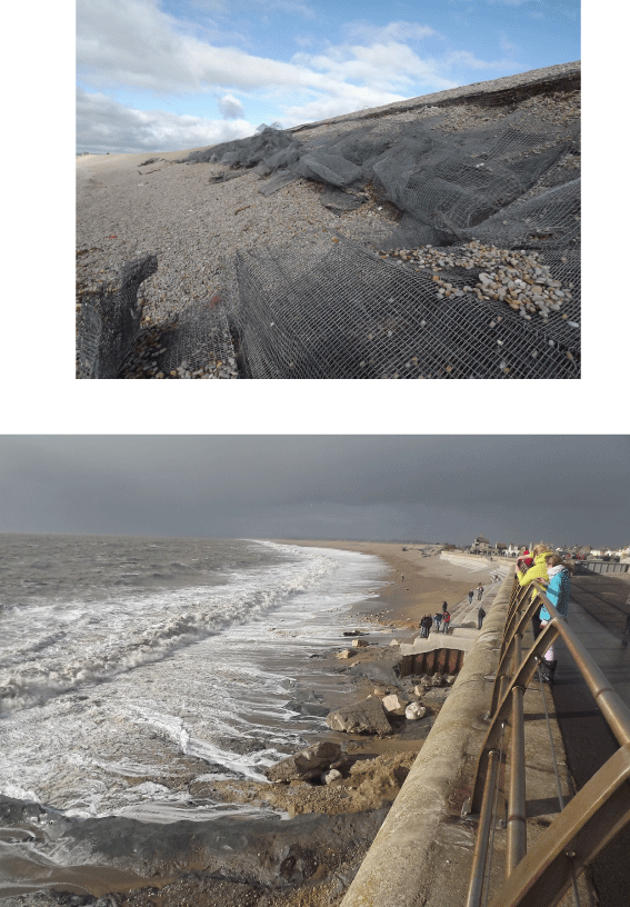
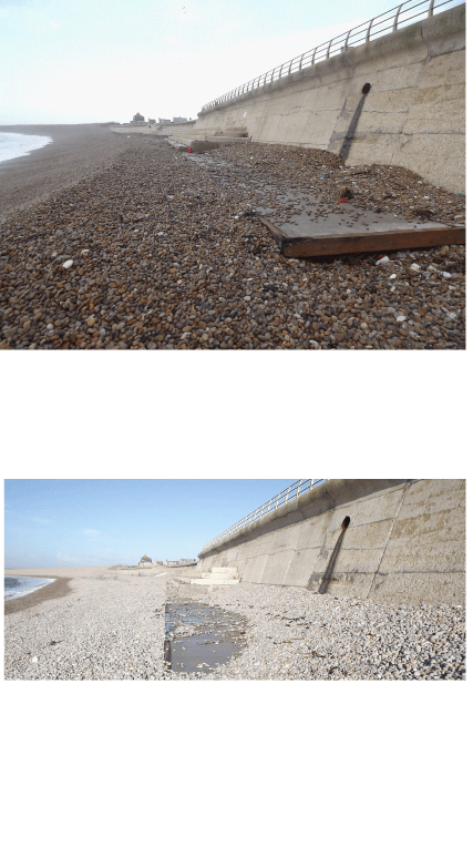
8th February: note level of shingle and exposed gabion mattresses
10th February: exposed gabion mattresses
15th February: beach level with shingle stripped and underlying bedrock (Kimmeridge Clay) exposed. A rare event
16th February: shingle level at 3.5 metres lower
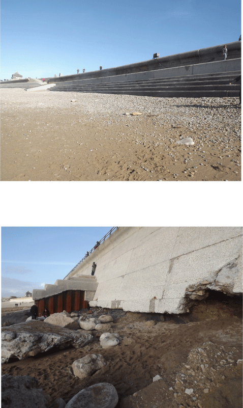
undermined sea wall in Chesil Cove after the storms
storm damage to esplanade
February 16th: the beach after several storms from mid-December
beach level 3rd February
beach level 5th February
photo taken 16th February
V
16th May 2013 Chesil Cove: state of the beach with shingle well up against the 1960 sea wall before any storm damage
V
V
v
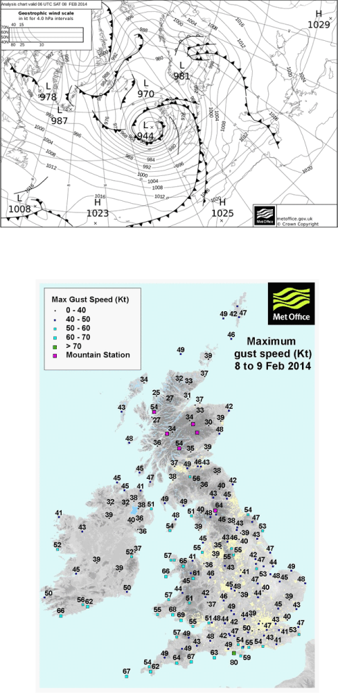
early February 2014 extreme storm conditions. 6 of '1 in 50 year storms' in 2 weeks
synoptic chart for 8th February 2014
Sequence of storms December 2013 to March 2014
22-24th December 2013
3-4th January 2014
6-7th January
1st February
4-9th February
12th February
14-16th February
3rd March 2014
information from the Environment Agency
Impact of storms
beach crest recession varied from 4 to 16 metres, average 10 metres
crest lowering up to 2 metres
3.5 metres lowering of beach in Chesil Cove
150,000 cubic metres of shingle moved off-shore
Management of the problems
protection for the undermined sea wall
mending the gabion tower and terrace
shingle management
road closures occurred cutting off Portland
data from: www.metoffice.gov.uk
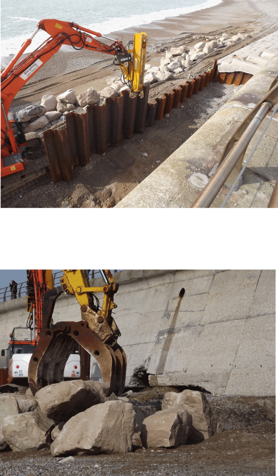
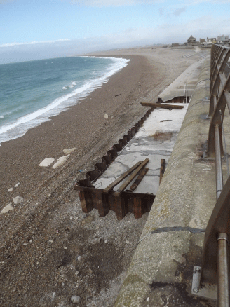
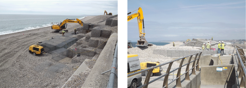
repairing the undermined sea wall
rock-armour (Portland Limestone) had been brought in to protect the sea wall while it was reinforced
18th March: piling completed and concrete poured
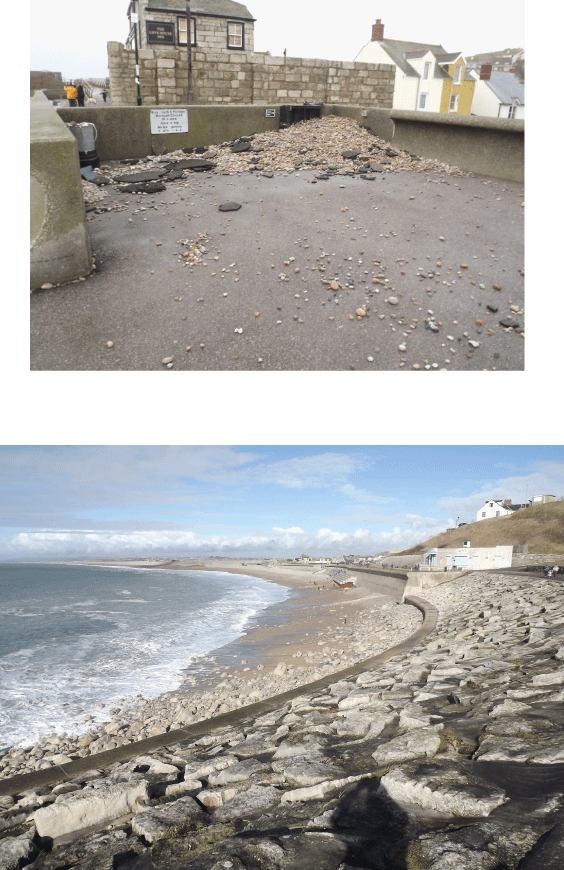
shingle had gone over the crest of the beach and minor flooding had occurred. The Cove Inn also suffered
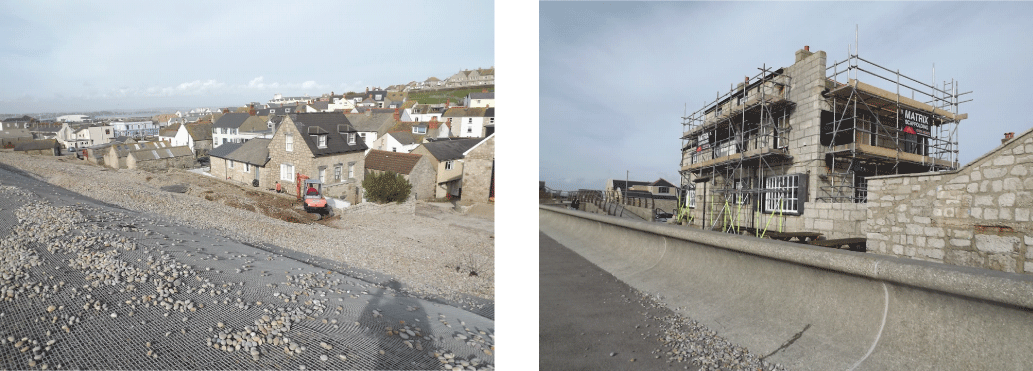
moving boulders/rock armour to protect southern end of the esplanade. End of April, completed protection for the undermined sea wall and some return of shingle
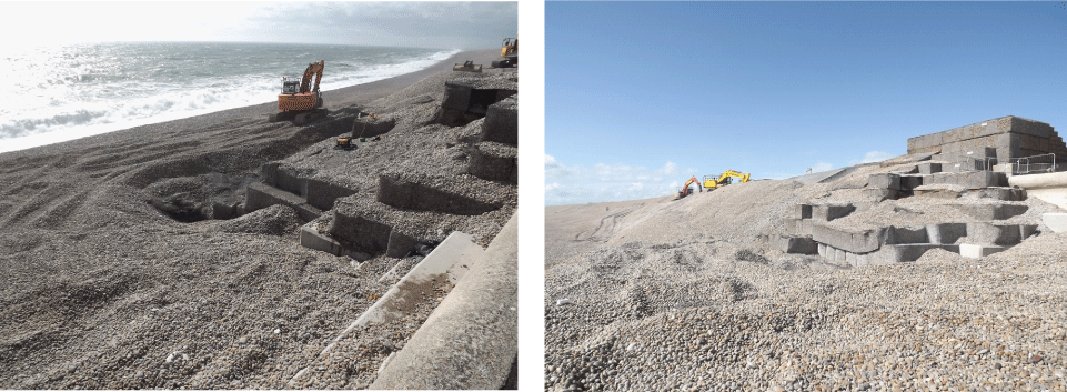
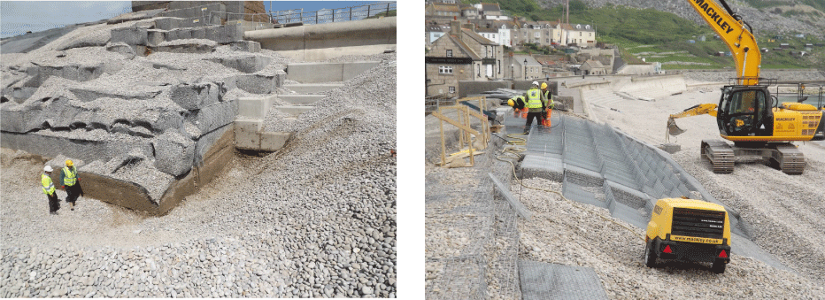
It was decided to rebuild the gabion tower rather than mend it. View of the tower in May
6th May: excavation to base of gabion tower and renewing the gabion mattresses mid-May
rebuilding the gabion tower in June and still in progress early August
Cost of remedial work?
Chesil Cove sea wall repair (WPBC asset) £285k
Chiswell gabion repairs (tower and mattresses) £758k
figures courtesy of the Environment Agency
10th August: little change apparent
3rd December 2014
9th January 2015: beach level
16th January 2015
beach damage, crest erosion
Cann development, shingle movement on lee side of beach
useful websites and articles
Managing the Wessex Coast. The Chesil sea defence scheme.
Geog. Rev. vol. 10, No. 2, March 1997. pp. 8-10
Chesil sea defence Scheme. Geog. Rev. vol. 22, No. 2, Nov. 2008. pp. 14-17
Storm damage and coastal protection: a case study of Chesil Cove.
Geog. Rev. vol. 28, No. 1, Sept. 2014. pp.38-41
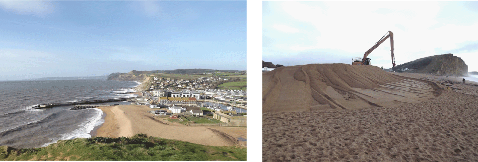
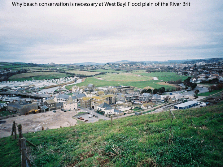
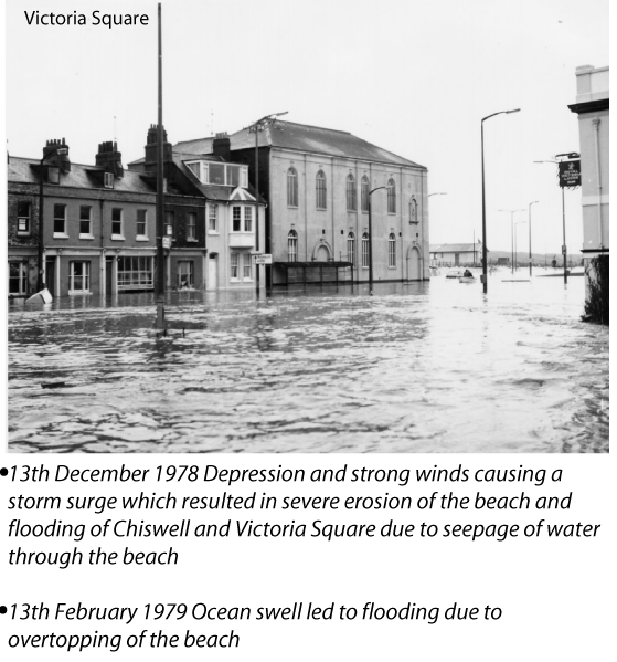
Why beach conservation is necessary at West Bay! Flood plain of the River Brit