C RWG
O
C RWG
O
C RWG
O
C RWG
O
C RWG
O
C RWG
O
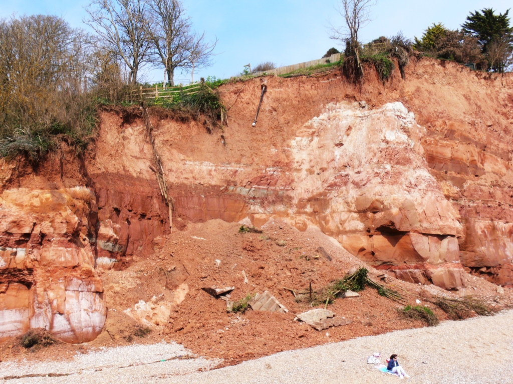
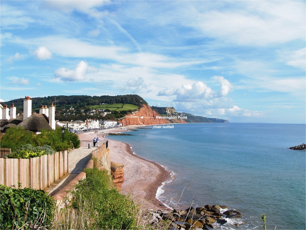
The rate of erosion at the former Pennington Point and in the cliffs 500 m eastwards from there has increased to the point where it is now one of the more rapidly retreating parts of the east Devon coast. The principal factors have been the vortex effect created by waves impinging on the eastern end of the promenade wall and the interruption of the west to east movement of beach gravel that protects the foot of the cliffs. The situation has been exacerbated by the presence of a collapsing Victorian railway tunnel that runs close to and parallel to the cliffs. Erosion in recent years has threatened the coastal path, several gardens, and a key geological section on the ‘Jurassic’ World Heritage coast.
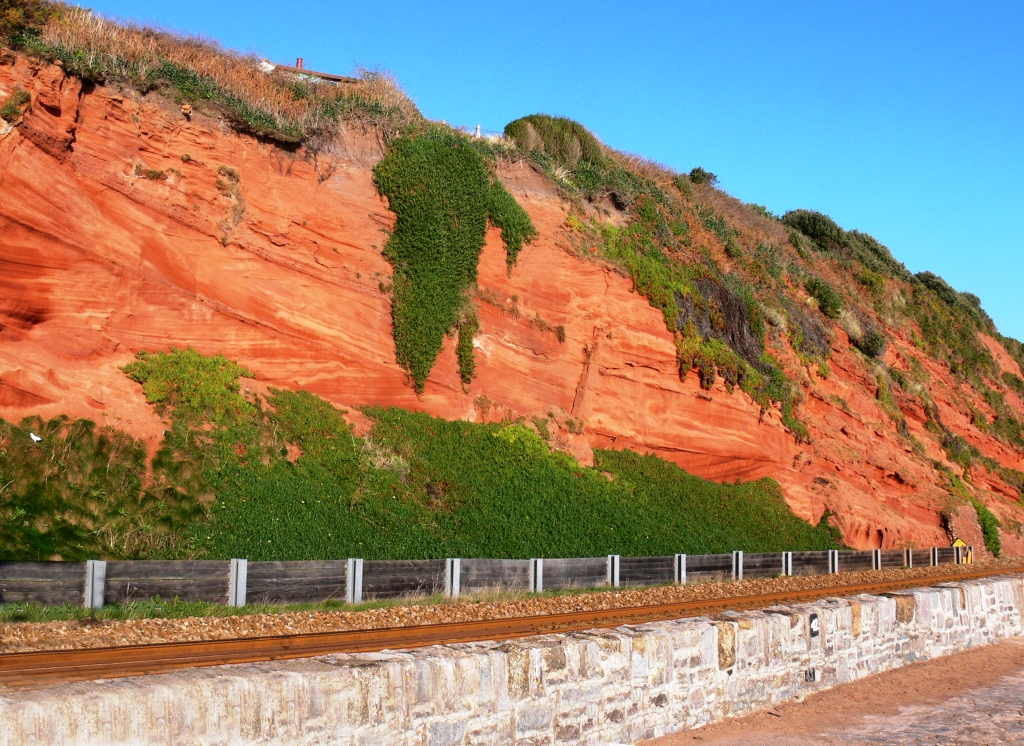
In medieval times Sidmouth was a small fishing village sited on higher ground adjacent to a salt marsh and anchorage point on the landward side of a high shingle beach in which the outfall of the River Sid gave access to the sea. The building of the esplanade wall in 1830 to protect buildings on top of the shingle beach and groynes to prevent the longshore drift of the shingle has resulted in an increase in erosion at the eastern end of the town. There, the former Pennington Point, a sandstone cliff that extended 100 m seaward of the cliff line, is now a rapidly eroding embayment.
Between Dawlish Warren and Teignmouth the London to Cornwall railway (opened in 1846) runs along the top of a sea wall at the foot of a cliff of Permian fossil sand dunes (Dawlish Sandstone). This, the boldest and most scenic of the lines built by Isambard Kingdom Brunel for the Great Western Railway, is the most expensive in the UK per kilometre of track to maintain.