References
Burland, J. B. and Gallois, R. W. 1967. CERN 300 GeV proton accelerator project: report on ground conditions at the British site. Science Research Council, London.
Ward, W. D., Burland, J. B. and Gallois, R. W. 1968. Geotechnical assessment of a site at Mundford, Norfolk,
for a large proton accelerator. Geotechnique, Vol. 18, 399-431.
Grainger, P., McCann, D. H. and Gallois, R. W. 1973. A seismic refraction technique for assessing fracture patterns
in the Middle Chalk at Mundford, Norfolk. Geotechnique, Vol. 23, 219-232.
Gallois, R. W. 1978. Geological investigations for the Wash Water Storage Feasibility Study.
Report of the Institute of Geological Sciences, No. 78/19, 1-78.
Gallois, R. W. and Horton, A. 1982. Field investigation of British Mesozoic and Tertiary mudstones.
Quarterly Journal of Engineering Geology, Vol. 14, 311-323.
Gallois, R. W. and Davis, G. M. 2001. Saving Lyme Regis from the sea: the results of recent geological site investigations. Geoscience in south-west England, Vol. 10, 183-189.
Brereton, N. R., Gallois, R. W. and Whittaker, A. 2001. Enhanced lithological description of some British mudrock sequences using geophysical wireline logs. Petroleum Geology, Vol. 7, 315-320.
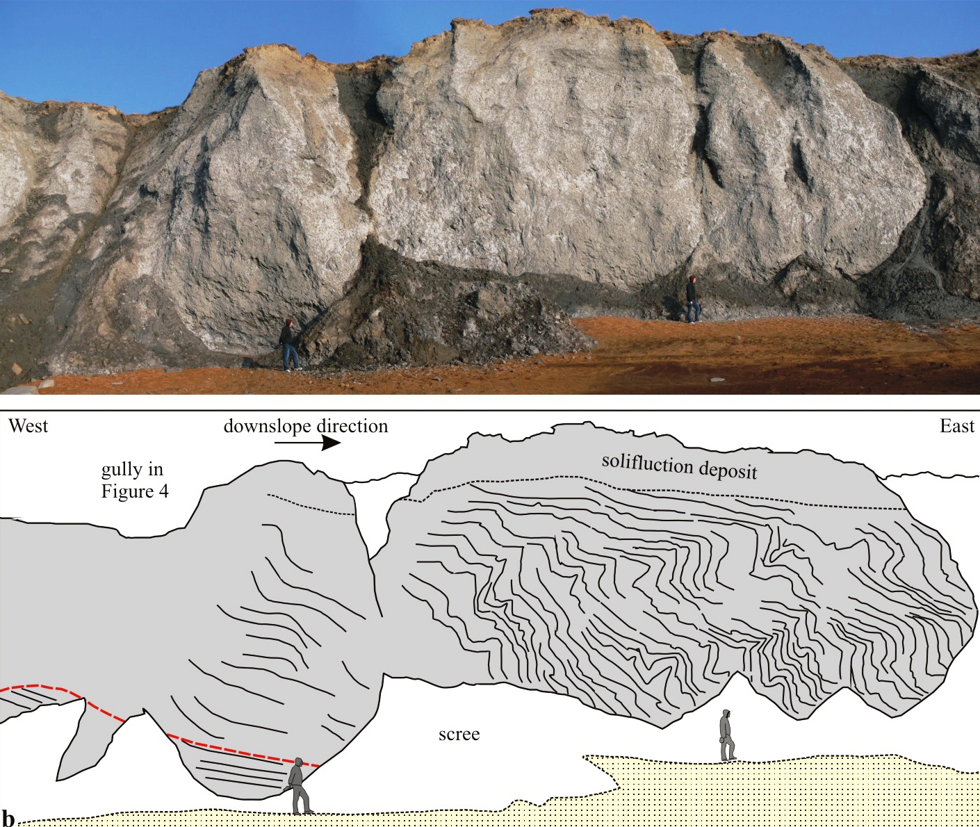
Gallois, R. W. 2010. Large-scale periglacial creep folds in Jurassic mudstones on the Dorset coast.
Geoscience in south-west England, Vol. 12.
Gallois, R. W. 2010. The stratigraphy of the Kimmeridge Clay Formation (Jurassic) of the Isle of Portland, Dorset, UK.
Geoscience in south-west England, Vol. 12.
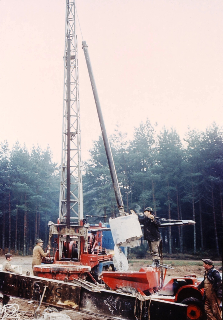
Drilling inspection shafts with a bucket auger, Mundford, Norfolk
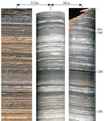
Millimetre-level correlations in the Freshwater Steps Stone Band, Dorset
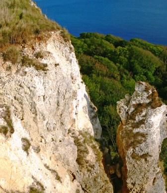
Detached pillar of Upper Greensand and Chalk, Bindon Cliffs, Devon
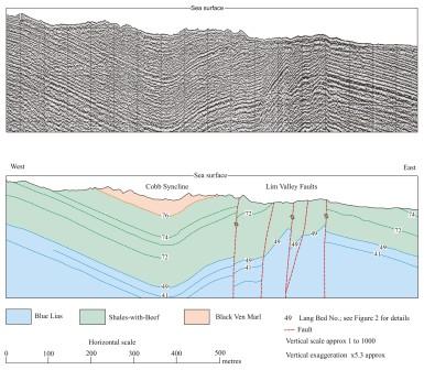
Seismic-reflection profile and its simplified geological interpretation, Blue Lias, Lyme Regis, Dorset
Large-scale periglacial creep folds in Lower Jurassic Lias mudstones, Seatown, Dorset
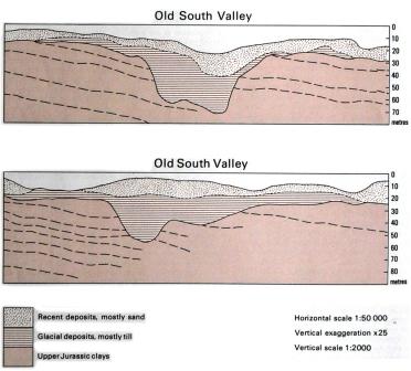
Sections through concealed drift-filled valleys beneath The Wash proved by seismic-reflection surveys.
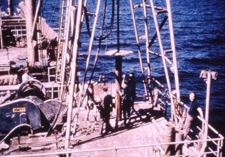
Continuous core drilling in The Wash from the Wimpey Sealab
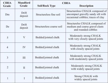
Mundford and CIRIA chalk engineering grades
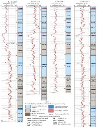
Combinations of stratigraphical marker beds such as the Freshwater Steps Stone Band and geophysical logs can be used to produce detailed correlations between site-investigation boreholes, Kimmeridge Clay, Isle of Portland, Dorset
Home Site Investigation Landslides Coastal Erosion Oil Shales Hot Springs Research Publications Contact
C RWG
O
C RWG
O
The introductory paragraph of the British Standard Code of Practice for Site Investigations (BS 5930, 1981) put it succinctly thus: the purpose of a site investigation is to assess the suitability of a site for the construction of civil engineering and building works and of acquiring knowledge of the characteristics of a site that affect the design and construction of such work and the security of neighbouring land and property. This should include a detailed knowledge of the past history of the site and its 3-D geology and hydrogeology, as well the geotechnical properties of the materials that will be encountered during the works. The acquisition of this data can be an expensive process that financial officers sometimes find difficult to accept.

click on images for additional information