o
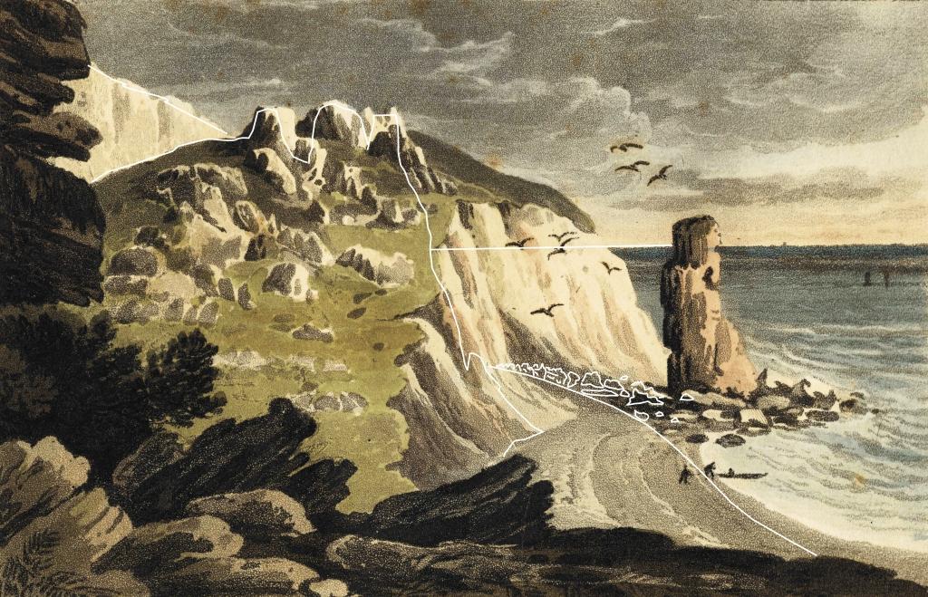
View of the Hooken landslide pinnacles from the west as depicted by the artist D Havell in 1819. Comparison with the present-day coastline, based on a photograph taken from the artist’s viewing point on the top of Martin’s Rock, shows that delicate pillars of Upper Greensand and Chalk up to 50 m high remained intact because they were supported within a matrix of fine-grained debris.
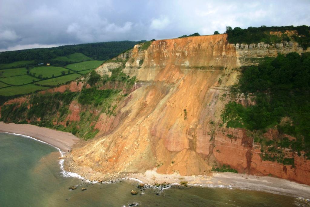
The landslide occurred in the early hours of January 4th 2006 at the western end of Higher Dunscombe Cliff, Salcombe Regis. No person or property was involved, but about 150 m of the Southwest Coastal Path and about 250,000 tonnes of Upper Greensand and Mercia Mudstone (Triassic) fell up to 160 m to the beach. The debris spread out to cover a 200+ m width of the beach and intertidal area. Blocks of calcareous sandstone up to 5x5x4 m came to rest below the low-water level of Spring tides. The failure surface was in a thin (<10 mm thick) bed of montmorillonite-rich mudstone close above the base of the Upper Greensand.
Reproduced courtesy of the Marine and Coastguard Agency (MCA), copyright MCA.
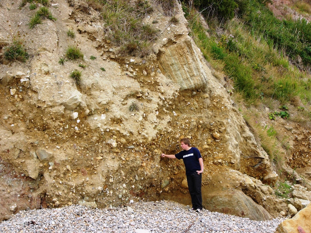
Similar failures in the Upper Greensand on the Devon coast close to Salcombe Regis also gave rise to debris flows that extended out beyond low-tide mark. The loose sand matrix composed of decalcified Foxmould is rapidly removed by marine erosion in the intertidal area. This leaves aprons of large (up to 100 tonnes) angular blocks of calcareous sandstone and calcarenite from the upper part of the Upper Greensand that survive for tens of years.
C RWG
O