C RWG
O
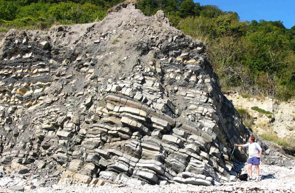
Triassic-Jurassic boundary beds, Charton Bay, Lyme Regis, Dorset.
Downfaulted mass of ‘Triassic’ White Lias Formation (Penarth Group) and ‘Jurassic’ Blue Lias Formation (Lias Group) exposed at Charton Bay. The Triassic-Jurassic boundary (arrowed), based on the current definition of the incoming of the ammonite Psiloceras planorbis J. Sowerby lies in the lower part of the Blue Lias. This is one of the best exposed examples of this system boundary in the UK. A newly proposed definition of the base of the Jurassic System is the incoming of the ammonite Psiloceras spelae Guex. This species is older than P. planorbis: it suggest that the boundary is at or close to the erosion surface that marks the base of the Blue Lias over much of Britain.
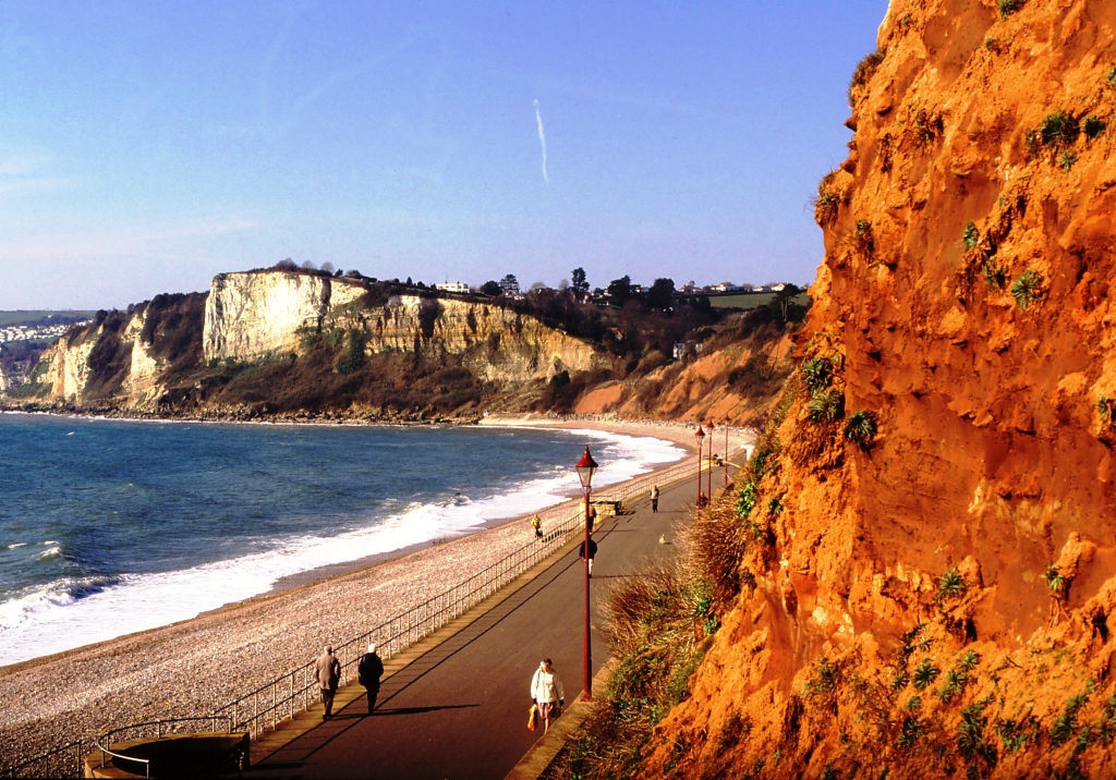
Triassic mudstones faulted against Cretaceous sandstones, White Cliff, Seaton, Devon.
The landforms of the World Heritage coast are strongly influenced by the underlying geological structure. All the major valleys are underlain by fault belts that mostly trend north-south to intersect the coast at a high angle. The Axe Valley is underlain by one such fault belt that is known from seismic reflection surveys and laterally variations in the Triassic to Cretaceous rocks on either side of the valley to have been intermittently active from the Permian until at least the late Miocene. At Seaton, the western boundary fault brings the Cretaceous Upper Greensand and Chalk into juxtaposition with the Triassic Mercia Mudstone.
v
C RWG
O
C RWG
O