Link to event summary opens in new tab
Tag: Somerset
Talk -The Complex Geology of the Somerset Coalfield
Dorset Geologist’s Association Group (DGAG) will host a talk on the Tuesday 10th December 2024.
Title: The Complex Geology of the Somerset Coalfield
Speaker: Andy Gordon: Born in Inverness, Scotland, gained a geology degree at Edinburgh University in 1982. Spent a few years working on oil drilling rigs, mostly in the Norwegian Arctic Circle in the glamorous role of mud-logger. In 1988 started a career in IT Networks and Data Communications in the Midlands before moving to Yeovil in 2021 and retiring in 2022. Joined the Somerset Geology Group and tagging along with Dorset Building Stones group, he has rediscovered his love of geology in this wonderful part of the world.
Time: Talk will start at 7pm; finish approximately 8pm
Venue: Activity Meeting Room: Dorford Centre, Bridport Road, Dorchester, DT1 1RR
Lecture Entry Cost: £6 (£5 for DGAG members) collected on room entry
Booking a seat: Contact DGAG events at email: cwebb48578@aol.com
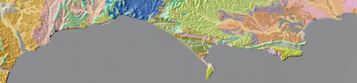
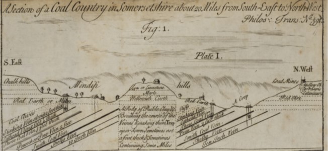
Talk Description: The talk is a summary of the speakers observations on the geology of the Somerset coalfield covering the last 300 plus years of interpretations/story crammed into 45 minute talk. The Somerset Coalfield is a bit of a secret to the rest of the country when we think about coal in the UK. The last coal pit closed in 1973. Starting with a ten-thousand-foot view of the geology of Somerset / the geology of the Somerset Coalfield, we will then drill down into the fossils found in the Somerset Coalfield (the largest collection of Carboniferous insects in Britain and the largest insect ever to fly). We will then get into the geological history of the Coalfield and debate why the Somerset Coalfield is the birthplace and home of English geology; and where the father of English strata geology did not give credit to a past Somerset geologist! Finally, we will get to the coalface and delve into the Variscan and later faulting, looking at early and contemporary maps and cross-sections. From the talk, you should have hopefully found it entertaining and come away with a good understanding of the history and geology of the Somerset Coalfield and an appreciation of the geology of Somerset. There will be an opportunity to challenge Andy with any questions throughout the talk.
Photo: Courtesy of the speaker: Section of Coal Country: John Strachey 1727
Additional Links:
- British Upper Carboniferous Stratigraphy : https://data.jncc.gov.uk/data/93992edc-4f36-403a-af95-fe8d2927d6ae/gcr-v11-british-upper-carboniferous-stratigraphy-c6.pdf
2. A useful starter explanation: https://kids.kiddle.co/Somerset_Coalfield
Mendips Natural Resources
A talk by Geologist David Rowley from Wells Cathedral School to discover more about Mendip’s unique geo resources.
Parking available at Wells Cathedral School.
Tickets £3 donation.
Max 40.
Booking
Field Trip to the Mendips

Although our last trip was only last week, the August trip is early in the month. It will be led by Martin Gledhill who has local interest and knowledge.
The trip is 5 mile walk but follows a figure of eight route with the cars parked in the centre of the eight. The first loop of the walk is only a mile and a half long and would be ideal for anyone who doesn’t feel up to the full 5 miles.
On the walk we shall see the lower Carboniferous limestone with several karst features including caves, sinkholes and a small gorge, together with Devonian sandstone and Triassic breccia. Much of the interest is in the remains of lead mining which goes back to Roman times. We shall see the remains of both open cast and deep mines, and the sites of crushing, washing and smelting the ore. We shall also see the remains of a Roman fort, township and amphitheatre. The latter is on private land but we can see it from a distance. The whole walk takes about 5 hours so a start time of 10.30 is required.
We meet at a large layby about 300 yards South East of St Hugh’s Church in Charterhouse. The map reference is ST 503 554.
To get there you turn left off the A37 at the Mendip Inn, which is 3 or 4 miles North of Shepton Mallet. You then follow the B3135, signposted Cheddar, for 7.5 miles. For some of this way you are on the straight line of the old Roman road which transported the Roman lead ingots from Charterhouse. After 7.5 miles, turn right, signposted to Charterhouse. After 2.5miles park in the large lay-by on the right, just above a dry valley full of “gruffy ground”, which is the local expression for land disturbed by lead mining. If you get to the church you have gone 300 yards too far.
Bring a packed lunch.
A different emphasis to our usual trips and in cooler weather it should be a good scenic walk!